
Panes topographic map
Interactive map
Click on the map to display elevation.
About this map
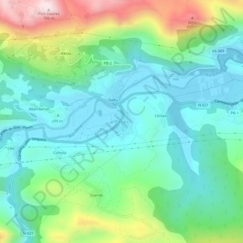
Name: Panes topographic map, elevation, terrain.
Location: Panes, Peñamellera Baja, Asturien, 33570, Spanien (43.30342 -4.60399 43.34342 -4.56399)
Average elevation: 196 m
Minimum elevation: 10 m
Maximum elevation: 687 m
Other topographic maps
Click on a map to view its topography, its elevation and its terrain.
Colosía
Spanien > Asturien > Peñamellera Baja > Panes
Colosía, Panes, Peñamellera Baja, Asturien, 33570, Spanien
Average elevation: 214 m