
Cornemont topographic map
Interactive map
Click on the map to display elevation.
About this map
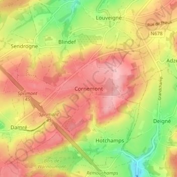
Name: Cornemont topographic map, elevation, terrain.
Location: Cornemont, Sprimont, Luik, Wallonië, 4141, België (50.49444 5.68328 50.53444 5.72328)
Average elevation: 260 m
Minimum elevation: 179 m
Maximum elevation: 319 m
Other topographic maps
Click on a map to view its topography, its elevation and its terrain.