
Twin Hills Village topographic map
Interactive map
Click on the map to display elevation.
About this map
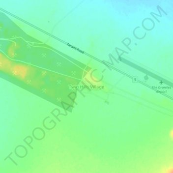
Name: Twin Hills Village topographic map, elevation, terrain.
Average elevation: 396 m
Minimum elevation: 384 m
Maximum elevation: 416 m
Other topographic maps
Click on a map to view its topography, its elevation and its terrain.
Lake Mackay
Australia > Central Desert Region
Lake Mackay, Central Desert Region, Northern Territory, Australia
Average elevation: 483 m
The Pinnacles
Australia > Central Desert Region
The Pinnacles, Central Desert Region, Northern Territory, Australia
Average elevation: 288 m
Yuendumu
Australia > Central Desert Region
Yuendumu, Central Desert Region, Northern Territory, Australia
Average elevation: 678 m
Nyirripi
Australia > Central Desert Region
Nyirripi, Central Desert Region, Northern Territory, Australia
Average elevation: 525 m
Willowra
Australia > Central Desert Region
Willowra, Central Desert Region, Northern Territory, 0872, Australia
Average elevation: 466 m
Lajamanu
Australia > Central Desert Region
Lajamanu, Central Desert Region, Northern Territory, Australia
Average elevation: 330 m
Tanami Desert
Australia > Central Desert Region
Tanami Desert, Tanami, Central Desert Region, Northern Territory, Australia
Average elevation: 319 m
The Granites
Australia > Central Desert Region
The Granites, Central Desert Region, Northern Territory, Australia
Average elevation: 403 m