
Thank you for supporting this site ❤️
Make a donation
Make a donation
Kasserine topographic map
Click on the map to display elevation.
Thank you for supporting this site ❤️
Make a donation
Make a donation
Kasserine
The theater was built at the end of the first century AD, probably to celebrate elevation of the town to a municipium, It was restored, and reopened for performances in 2018.
Thank you for supporting this site ❤️
Make a donation
Make a donation
About this map
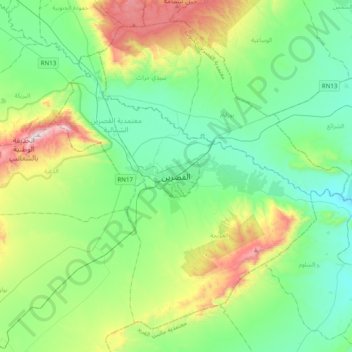
Name: Kasserine topographic map, elevation, terrain.
Average elevation: 797 m
Minimum elevation: 543 m
Maximum elevation: 1,529 m
Thank you for supporting this site ❤️
Make a donation
Make a donation