
Jalore topographic map
Interactive map
Click on the map to display elevation.
About this map
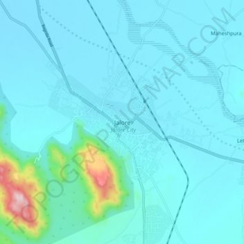
Name: Jalore topographic map, elevation, terrain.
Location: Jalore, Jalor Tehsil, Jalore District, Rajasthan, 343001, Inde (25.30760 72.58609 25.38760 72.66609)
Average elevation: 208 m
Minimum elevation: 151 m
Maximum elevation: 727 m
Other topographic maps
Click on a map to view its topography, its elevation and its terrain.
Leta
Inde > Rajasthan > Jalor Tehsil
Leta, Jalor Tehsil, Jalore District, Rajasthan, Inde
Average elevation: 173 m