
Bethesda topographic map
Click on the map to display elevation.
About this map
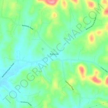
Name: Bethesda topographic map, elevation, terrain.
Average elevation: 263 m
Minimum elevation: 228 m
Maximum elevation: 341 m
Other topographic maps
Click on a map to view its topography, its elevation and its terrain.
Fairview
United States > Tennessee > Williamson County
Fairview was incorporated on July 28, 1959, under the Uniform City Manager-Commission Charter as set out in the Tennessee Code Annotated. Fairview city limits are located about one mile (1.6 km) southwest from the Nashville-Davidson County line and has two interstates passing through it (I-40 & I-840). With an…
Average elevation: 233 m
Carrington Hills Pond
United States > Tennessee > Williamson County > Franklin
Average elevation: 224 m
Fairview
United States > Tennessee > Williamson County
Fairview was incorporated on July 28, 1959, under the Uniform City Manager-Commission Charter as set out in the Tennessee Code Annotated. Fairview city limits are located about one mile (1.6 km) southwest from the Nashville-Davidson County line and has two interstates passing through it (I-40 & I-840). With an…
Average elevation: 233 m