
Chapala topographic map
Interactive map
Click on the map to display elevation.
About this map
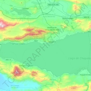
Name: Chapala topographic map, elevation, terrain.
Location: Chapala, Jalisco, Mexico (20.15260 -103.42201 20.40656 -103.02299)
Average elevation: 1,646 m
Minimum elevation: 1,349 m
Maximum elevation: 2,827 m
Other topographic maps
Click on a map to view its topography, its elevation and its terrain.