
Thank you for supporting this site ❤️
Make a donation
Make a donation
Bulls Lodge topographic map
Click on the map to display elevation.
Thank you for supporting this site ❤️
Make a donation
Make a donation
About this map
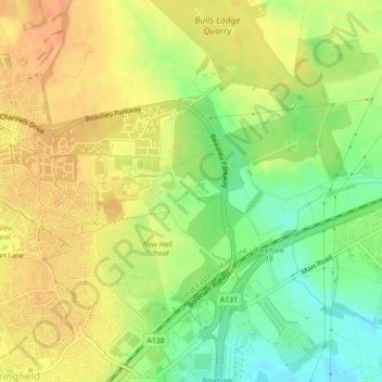
Name: Bulls Lodge topographic map, elevation, terrain.
Average elevation: 43 m
Minimum elevation: 18 m
Maximum elevation: 61 m
Thank you for supporting this site ❤️
Make a donation
Make a donation
Other topographic maps
Click on a map to view its topography, its elevation and its terrain.
Thank you for supporting this site ❤️
Make a donation
Make a donation
Hanningfield Reservoir
United Kingdom > England > Essex > Chelmsford > South Hanningfield
Average elevation: 56 m
Thank you for supporting this site ❤️
Make a donation
Make a donation
South Hanningfield
United Kingdom > England > Essex > Chelmsford > Ramsden Heath
Average elevation: 57 m