
Malscheid topographic map
Interactive map
Click on the map to display elevation.
About this map
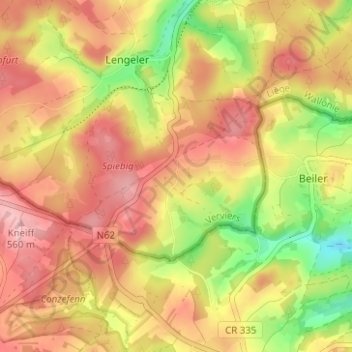
Name: Malscheid topographic map, elevation, terrain.
Location: Malscheid, Burg-Reuland, Luik, Wallonië, België (50.14304 6.04471 50.18304 6.08471)
Average elevation: 500 m
Minimum elevation: 413 m
Maximum elevation: 561 m