
Sangerhausen topographic map
Interactive map
Click on the map to display elevation.
About this map
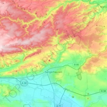
Name: Sangerhausen topographic map, elevation, terrain.
Location: Sangerhausen, Mansfeld-Südharz, Saksen-Anhalt, Duitsland (51.41435 11.07100 51.59866 11.38706)
Average elevation: 262 m
Minimum elevation: 122 m
Maximum elevation: 457 m