
Chavornay topographic map
Interactive map
Click on the map to display elevation.
About this map
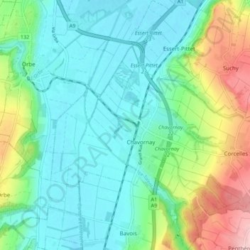
Name: Chavornay topographic map, elevation, terrain.
Location: Chavornay, District du Jura-Nord vaudois, Vaud, 1373, Suisse (46.68151 6.53921 46.73878 6.60379)
Average elevation: 485 m
Minimum elevation: 433 m
Maximum elevation: 627 m