
Thank you for supporting this site ❤️
Make a donation
Make a donation
Cayo Costa topographic map
Click on the map to display elevation.
Thank you for supporting this site ❤️
Make a donation
Make a donation
About this map
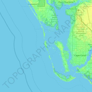
Name: Cayo Costa topographic map, elevation, terrain.
Location: Cayo Costa, Lee County, Florida, USA (26.34952 -82.56648 26.98952 -81.92648)
Average elevation: 1 m
Minimum elevation: -2 m
Maximum elevation: 12 m
Thank you for supporting this site ❤️
Make a donation
Make a donation
Other topographic maps
Click on a map to view its topography, its elevation and its terrain.