
Tato topographic map
Interactive map
Click on the map to display elevation.
About this map
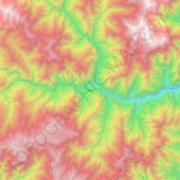
Name: Tato topographic map, elevation, terrain.
Location: Tato, Tato EAC, Shi Yomi District, Arunachal Pradesh, Indien (28.37149 94.21531 28.69149 94.53531)
Average elevation: 2,488 m
Minimum elevation: 663 m
Maximum elevation: 4,225 m