
Ecclesfield topographic map
Click on the map to display elevation.
About this map
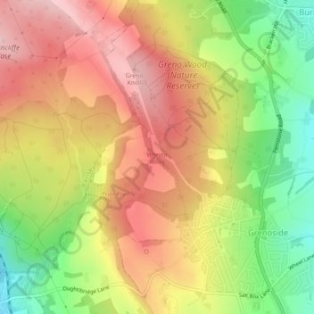
Name: Ecclesfield topographic map, elevation, terrain.
Average elevation: 217 m
Minimum elevation: 106 m
Maximum elevation: 307 m
Other topographic maps
Click on a map to view its topography, its elevation and its terrain.
Ecclesfield
United Kingdom > England > Sheffield > Whitley
Ecclesfield lies in the north of Sheffield, about 4 miles (7 km) north of the city centre. The suburb of Ecclesfield is in the south-east of the civil parish with the suburbs Chapeltown and High Green to the north, and Grenoside to the west. Its altitude is 60 metres (200 ft) to 120 metres (390 ft) above mean…
Average elevation: 128 m