
Thank you for supporting this site ❤️
Make a donation
Make a donation
Hody topographic map
Click on the map to display elevation.
Thank you for supporting this site ❤️
Make a donation
Make a donation
About this map
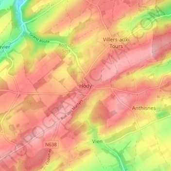
Name: Hody topographic map, elevation, terrain.
Location: Hody, Anthisnes, Huy, Liège, Wallonie, 4162, Belgique (50.46691 5.48100 50.50691 5.52100)
Average elevation: 253 m
Minimum elevation: 170 m
Maximum elevation: 296 m
Thank you for supporting this site ❤️
Make a donation
Make a donation
Other topographic maps
Click on a map to view its topography, its elevation and its terrain.
Thank you for supporting this site ❤️
Make a donation
Make a donation