
Ronse topographic map
Interactive map
Click on the map to display elevation.
About this map
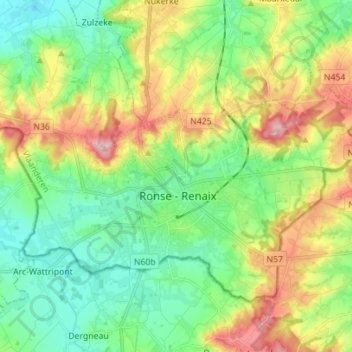
Name: Ronse topographic map, elevation, terrain.
Location: Ronse, Ostflandern, Flandern, 9600, Belgien (50.72101 3.53789 50.78419 3.67760)
Average elevation: 61 m
Minimum elevation: 9 m
Maximum elevation: 154 m