
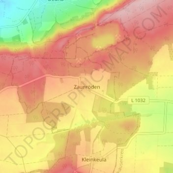
Zaunröden topographic map
Interactive map
Click on the map to display elevation.
About this map
Name: Zaunröden topographic map, elevation, terrain.
Location: Zaunröden, Unstrut-Hainich-Kreis, Thüringen, Duitsland (51.31424 10.46773 51.35424 10.50773)
Average elevation: 443 m
Minimum elevation: 326 m
Maximum elevation: 520 m