
Stadtbezirk Bremen-Nord topographic map
Interactive map
Click on the map to display elevation.
About this map
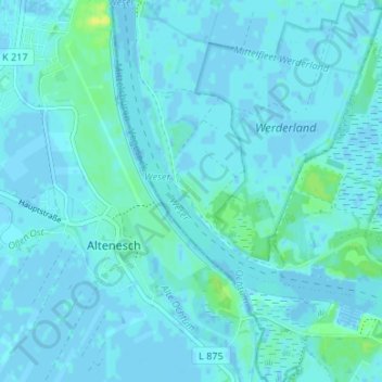
Name: Stadtbezirk Bremen-Nord topographic map, elevation, terrain.
Location: Stadtbezirk Bremen-Nord, Niederbüren, Brême, 28759, Allemagne (53.11647 8.61858 53.15647 8.65858)
Average elevation: 2 m
Minimum elevation: -3 m
Maximum elevation: 14 m