
Les Giettes topographic map
Interactive map
Click on the map to display elevation.
About this map
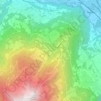
Name: Les Giettes topographic map, elevation, terrain.
Location: Les Giettes, Monthey, Valais, 1871, Suisse (46.20537 6.94235 46.24537 6.98235)
Average elevation: 1,019 m
Minimum elevation: 397 m
Maximum elevation: 2,037 m