
Thank you for supporting this site ❤️
Make a donation
Make a donation
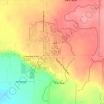
Melba topographic map
Click on the map to display elevation.
Thank you for supporting this site ❤️
Make a donation
Make a donation
Melba
Melba is located at 43°22′25″N 116°31′45″W / 43.37361°N 116.52917°W / 43.37361; -116.52917 (43.373487, -116.529194). at an elevation of 2,667 feet (813 m) above sea level. It is 12 miles (19 km) south of Nampa, and three miles (5 km) northeast of the Snake River.
Thank you for supporting this site ❤️
Make a donation
Make a donation
About this map
Name: Melba topographic map, elevation, terrain.
Location: Melba, Canyon County, Idaho, United States (43.36544 -116.54158 43.38086 -116.52360)
Average elevation: 798 m
Minimum elevation: 733 m
Maximum elevation: 837 m
Thank you for supporting this site ❤️
Make a donation
Make a donation