
Thank you for supporting this site ❤️
Make a donation
Make a donation
El Calafate topographic map
Click on the map to display elevation.
Thank you for supporting this site ❤️
Make a donation
Make a donation
About this map
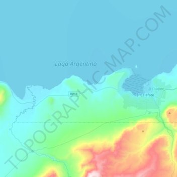
Name: El Calafate topographic map, elevation, terrain.
Location: El Calafate, Lago Argentino, Santa Cruz, Z9405, Argentina (-50.37571 -72.52231 -50.28511 -72.14846)
Average elevation: 336 m
Minimum elevation: 177 m
Maximum elevation: 1,424 m
Thank you for supporting this site ❤️
Make a donation
Make a donation
Other topographic maps
Click on a map to view its topography, its elevation and its terrain.