
Thank you for supporting this site ❤️
Make a donation
Make a donation
Lennik topographic map
Click on the map to display elevation.
Thank you for supporting this site ❤️
Make a donation
Make a donation
About this map
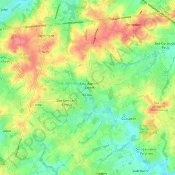
Name: Lennik topographic map, elevation, terrain.
Location: Lennik, Hal-Vilvorde, Brabant flamand, Flandre, 1750, Belgique (50.77966 4.10890 50.84321 4.21168)
Average elevation: 57 m
Minimum elevation: 26 m
Maximum elevation: 97 m
Thank you for supporting this site ❤️
Make a donation
Make a donation