High Knob topographic map
Click on the map to display elevation.
About this map
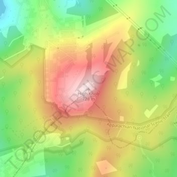
Name: High Knob topographic map, elevation, terrain.
Average elevation: 511 m
Minimum elevation: 315 m
Maximum elevation: 716 m

Click on the map to display elevation.
Name: High Knob topographic map, elevation, terrain.
Average elevation: 511 m
Minimum elevation: 315 m
Maximum elevation: 716 m