
Thank you for supporting this site ❤️
Make a donation
Make a donation
Maden Mahallesi topographic map
Click on the map to display elevation.
Thank you for supporting this site ❤️
Make a donation
Make a donation
About this map
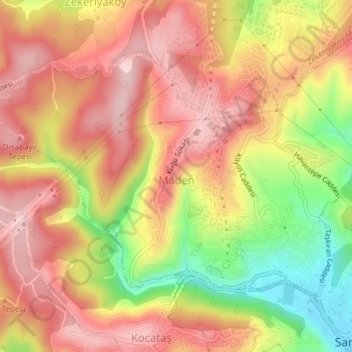
Name: Maden Mahallesi topographic map, elevation, terrain.
Location: Maden Mahallesi, Sarıyer, Istanbul, Marmara Region, Turkey (41.17219 29.01769 41.19206 29.05580)
Average elevation: 146 m
Minimum elevation: 6 m
Maximum elevation: 235 m
Thank you for supporting this site ❤️
Make a donation
Make a donation
Other topographic maps
Click on a map to view its topography, its elevation and its terrain.