
Thank you for supporting this site ❤️
Make a donation
Make a donation
Grundarfjörður topographic map
Click on the map to display elevation.
Thank you for supporting this site ❤️
Make a donation
Make a donation
About this map
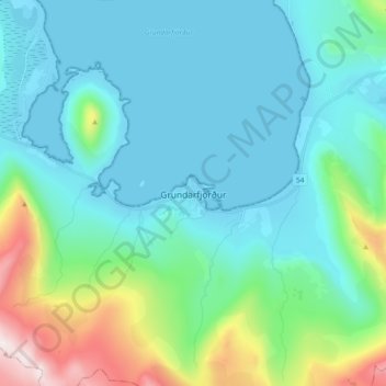
Name: Grundarfjörður topographic map, elevation, terrain.
Location: Grundarfjörður, Grundarfjarðarbær, 350, Iceland (64.88503 -23.29930 64.96503 -23.21930)
Average elevation: 181 m
Minimum elevation: -3 m
Maximum elevation: 970 m
Thank you for supporting this site ❤️
Make a donation
Make a donation