
Thank you for supporting this site ❤️
Make a donation
Make a donation
Lac Dycie topographic map
Click on the map to display elevation.
Thank you for supporting this site ❤️
Make a donation
Make a donation
About this map
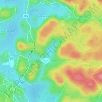
Name: Lac Dycie topographic map, elevation, terrain.
Average elevation: 179 m
Minimum elevation: 139 m
Maximum elevation: 241 m
Thank you for supporting this site ❤️
Make a donation
Make a donation
Other topographic maps
Click on a map to view its topography, its elevation and its terrain.
Saint-Pierre de Wakefield
Canada > Quebec > Les Collines-de-l'Outaouais > Val-des-Monts
Average elevation: 224 m
Thank you for supporting this site ❤️
Make a donation
Make a donation