
Jesús topographic map
Interactive map
Click on the map to display elevation.
About this map
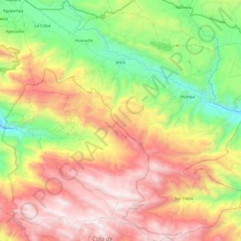
Name: Jesús topographic map, elevation, terrain.
Location: Jesús, Cajamarca, Pérou (-7.40272 -78.46549 -7.19605 -78.27175)
Average elevation: 3,208 m
Minimum elevation: 2,307 m
Maximum elevation: 4,205 m