
Thank you for supporting this site ❤️
Make a donation
Make a donation
Obalj topographic map
Click on the map to display elevation.
Thank you for supporting this site ❤️
Make a donation
Make a donation
About this map
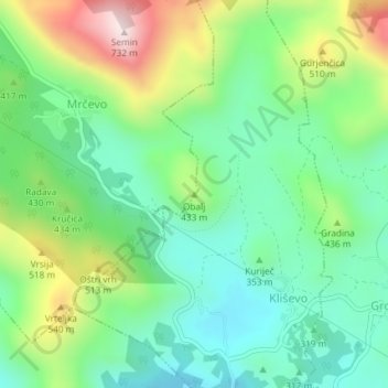
Name: Obalj topographic map, elevation, terrain.
Location: Obalj, Dubrovnik, Dubrovnik-Neretva County, 20234, Croatia (42.73412 17.99307 42.73422 17.99317)
Average elevation: 376 m
Minimum elevation: 206 m
Maximum elevation: 721 m
Thank you for supporting this site ❤️
Make a donation
Make a donation
Other topographic maps
Click on a map to view its topography, its elevation and its terrain.