
Alto Urgel topographic map
Interactive map
Click on the map to display elevation.
About this map
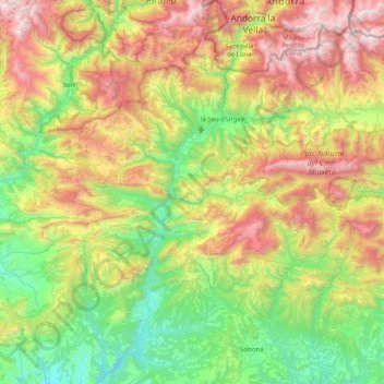
Name: Alto Urgel topographic map, elevation, terrain.
Location: Alto Urgel, Lérida, Cataluña, España (41.93921 1.12270 42.54369 1.69506)
Average elevation: 1,262 m
Minimum elevation: 376 m
Maximum elevation: 2,922 m