
Linth topographic map
Interactive map
Click on the map to display elevation.
About this map
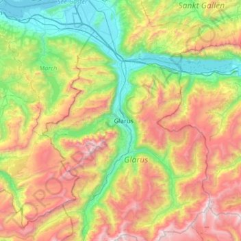
Name: Linth topographic map, elevation, terrain.
Location: Linth, Wahlkreis See-Gaster, Glaris, 8872, Suisse (46.86589 8.94148 47.21816 9.12170)
Average elevation: 1,418 m
Minimum elevation: 401 m
Maximum elevation: 3,129 m