
Thank you for supporting this site ❤️
Make a donation
Make a donation
North Water Bridge topographic map
Click on the map to display elevation.
Thank you for supporting this site ❤️
Make a donation
Make a donation
About this map
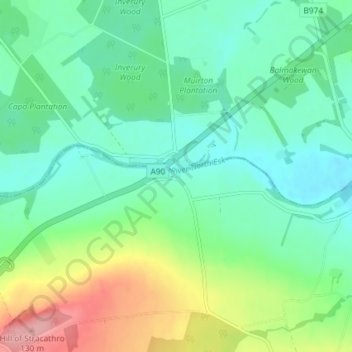
Name: North Water Bridge topographic map, elevation, terrain.
Location: North Water Bridge, Angus, Scotland, AB30 1QN, United Kingdom (56.76490 -2.59023 56.80490 -2.55023)
Average elevation: 51 m
Minimum elevation: 18 m
Maximum elevation: 131 m
Thank you for supporting this site ❤️
Make a donation
Make a donation
Other topographic maps
Click on a map to view its topography, its elevation and its terrain.
Thank you for supporting this site ❤️
Make a donation
Make a donation
Thank you for supporting this site ❤️
Make a donation
Make a donation
Thank you for supporting this site ❤️
Make a donation
Make a donation
Thank you for supporting this site ❤️
Make a donation
Make a donation