
Thank you for supporting this site ❤️
Make a donation
Make a donation
Jatibanteng topographic map
Click on the map to display elevation.
Thank you for supporting this site ❤️
Make a donation
Make a donation
About this map
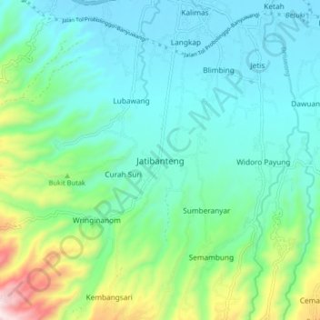
Name: Jatibanteng topographic map, elevation, terrain.
Location: Jatibanteng, Situbondo, East Java, Java, Indonesia (-7.81761 113.64428 -7.73761 113.72428)
Average elevation: 157 m
Minimum elevation: 3 m
Maximum elevation: 691 m
Thank you for supporting this site ❤️
Make a donation
Make a donation