
Thank you for supporting this site ❤️
Make a donation
Make a donation
Pancalang topographic map
Click on the map to display elevation.
Thank you for supporting this site ❤️
Make a donation
Make a donation
About this map
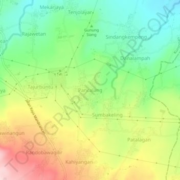
Name: Pancalang topographic map, elevation, terrain.
Location: Pancalang, Kuningan, West Java, Java, 45558, Indonesia (-6.84152 108.47166 -6.80152 108.51166)
Average elevation: 325 m
Minimum elevation: 210 m
Maximum elevation: 484 m
Thank you for supporting this site ❤️
Make a donation
Make a donation
Other topographic maps
Click on a map to view its topography, its elevation and its terrain.