
Almondsbury topographic map
Interactive map
Click on the map to display elevation.
About this map
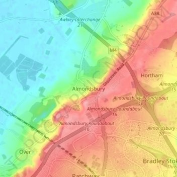
Name: Almondsbury topographic map, elevation, terrain.
Average elevation: 47 m
Minimum elevation: 5 m
Maximum elevation: 93 m
Other topographic maps
Click on a map to view its topography, its elevation and its terrain.
Patchway
Royaume-Uni > Angleterre > Almondsbury
Patchway, Almondsbury, South Gloucestershire, South West England, Angleterre, BS32 4, Royaume-Uni
Average elevation: 67 m