
Isle of Sheppey topographic map
Interactive map
Click on the map to display elevation.
About this map
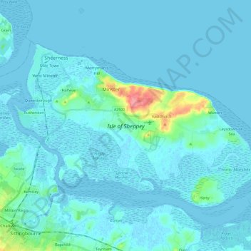
Name: Isle of Sheppey topographic map, elevation, terrain.
Location: Isle of Sheppey, Borough of Swale, Kent, England, United Kingdom (51.35449 0.72172 51.44779 0.95090)
Average elevation: 6 m
Minimum elevation: -4 m
Maximum elevation: 74 m