
Nápoles topographic map
Interactive map
Click on the map to display elevation.
About this map
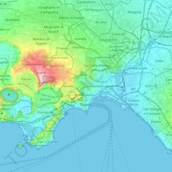
Name: Nápoles topographic map, elevation, terrain.
Location: Nápoles, Napoli, Campania, Itália (40.79119 14.13210 40.91612 14.35377)
Average elevation: 65 m
Minimum elevation: -2 m
Maximum elevation: 457 m
Other topographic maps
Click on a map to view its topography, its elevation and its terrain.