
Thank you for supporting this site ❤️
Make a donation
Make a donation
Wetaskiwin topographic map
Click on the map to display elevation.
Thank you for supporting this site ❤️
Make a donation
Make a donation
Wetaskiwin
The city lies at an elevation of 760 m (2,490 ft). Coal Lake, a reservoir developed on the Battle River is located immediately east of the city, and other nearby waterways include Pipestone Creek, Bigstone Creek, Bittern Lake and Bearhills Lake.
Thank you for supporting this site ❤️
Make a donation
Make a donation
About this map
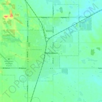
Name: Wetaskiwin topographic map, elevation, terrain.
Location: Wetaskiwin, Alberta, Canada (52.94288 -113.42641 52.99623 -113.32960)
Average elevation: 760 m
Minimum elevation: 749 m
Maximum elevation: 789 m
Thank you for supporting this site ❤️
Make a donation
Make a donation
Other topographic maps
Click on a map to view its topography, its elevation and its terrain.