
Thank you for supporting this site ❤️
Make a donation
Make a donation
Lampaseh Kota topographic map
Click on the map to display elevation.
Thank you for supporting this site ❤️
Make a donation
Make a donation
About this map
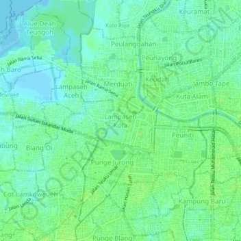
Name: Lampaseh Kota topographic map, elevation, terrain.
Location: Lampaseh Kota, Banda Aceh, Aceh, 23241, Indonesia (5.53228 95.29484 5.57228 95.33484)
Average elevation: 6 m
Minimum elevation: -1 m
Maximum elevation: 10 m
Thank you for supporting this site ❤️
Make a donation
Make a donation
Other topographic maps
Click on a map to view its topography, its elevation and its terrain.
Thank you for supporting this site ❤️
Make a donation
Make a donation
Thank you for supporting this site ❤️
Make a donation
Make a donation
Thank you for supporting this site ❤️
Make a donation
Make a donation