
Bergen topographic map
Interactive map
Click on the map to display elevation.
About this map
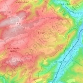
Name: Bergen topographic map, elevation, terrain.
Average elevation: 355 m
Minimum elevation: 189 m
Maximum elevation: 480 m
Other topographic maps
Click on a map to view its topography, its elevation and its terrain.
Heimbach
Allemagne > Rhénanie-Palatinat > Landkreis Birkenfeld > Heimbach
Heimbach, Baumholder, Landkreis Birkenfeld, Rhénanie-Palatinat, Allemagne
Average elevation: 412 m