
Thank you for supporting this site ❤️
Make a donation
Make a donation
East Andover topographic map
Click on the map to display elevation.
Thank you for supporting this site ❤️
Make a donation
Make a donation
About this map
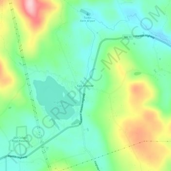
Name: East Andover topographic map, elevation, terrain.
Average elevation: 236 m
Minimum elevation: 169 m
Maximum elevation: 371 m
Thank you for supporting this site ❤️
Make a donation
Make a donation
Other topographic maps
Click on a map to view its topography, its elevation and its terrain.
Andover
United States > New Hampshire > Merrimack County > Andover
According to the United States Census Bureau, the town has a total area of 41.4 square miles (107.3 km2), of which 40.5 sq mi (105.0 km2) is land and 0.89 sq mi (2.3 km2) is water, comprising 2.14% of the town. Andover is drained by the Blackwater River. Bradley Lake is in the south. Ragged Mountain, elevation…
Average elevation: 301 m