
Thank you for supporting this site ❤️
Make a donation
Make a donation
White Mountain topographic map
Click on the map to display elevation.
Thank you for supporting this site ❤️
Make a donation
Make a donation
About this map
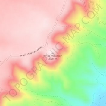
Name: White Mountain topographic map, elevation, terrain.
Location: White Mountain, Sweetwater County, Wyoming, United States (41.57797 -109.32018 41.57807 -109.32008)
Average elevation: 2,170 m
Minimum elevation: 1,900 m
Maximum elevation: 2,328 m
Thank you for supporting this site ❤️
Make a donation
Make a donation
Other topographic maps
Click on a map to view its topography, its elevation and its terrain.
Arrowhead Springs
United States > Wyoming > Sweetwater County > Arrowhead Springs
Average elevation: 2,056 m
Thank you for supporting this site ❤️
Make a donation
Make a donation