
Thank you for supporting this site ❤️
Make a donation
Make a donation
La Gloria topographic map
Click on the map to display elevation.
Thank you for supporting this site ❤️
Make a donation
Make a donation
About this map
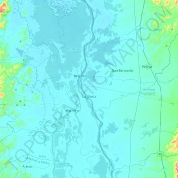
Name: La Gloria topographic map, elevation, terrain.
Location: La Gloria, Cesar, Colombia (8.44723 -73.81982 8.82180 -73.41163)
Average elevation: 56 m
Minimum elevation: 24 m
Maximum elevation: 597 m
Thank you for supporting this site ❤️
Make a donation
Make a donation
Other topographic maps
Click on a map to view its topography, its elevation and its terrain.