
Thank you for supporting this site ❤️
Make a donation
Make a donation
Gairo topographic map
Click on the map to display elevation.
Thank you for supporting this site ❤️
Make a donation
Make a donation
About this map
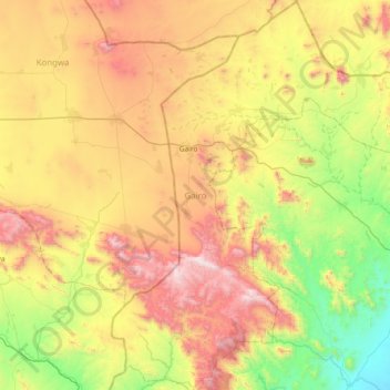
Name: Gairo topographic map, elevation, terrain.
Location: Gairo, Morogoro, Coastal Zone, Tanzania (-6.59892 36.72254 -5.86049 37.38872)
Average elevation: 1,133 m
Minimum elevation: 399 m
Maximum elevation: 2,244 m
Thank you for supporting this site ❤️
Make a donation
Make a donation