
Thank you for supporting this site ❤️
Make a donation
Make a donation
Lake Henry topographic map
Click on the map to display elevation.
Thank you for supporting this site ❤️
Make a donation
Make a donation
About this map
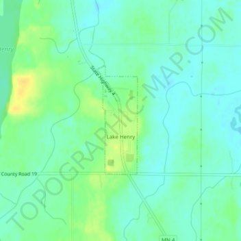
Name: Lake Henry topographic map, elevation, terrain.
Location: Lake Henry, Stearns County, Minnesota, United States (45.45631 -94.80023 45.46848 -94.79372)
Average elevation: 393 m
Minimum elevation: 384 m
Maximum elevation: 408 m
Thank you for supporting this site ❤️
Make a donation
Make a donation
Other topographic maps
Click on a map to view its topography, its elevation and its terrain.
Pearl Lake
United States > Minnesota > Stearns County > Maine Prairie Township
Average elevation: 343 m