
Thank you for supporting this site ❤️
Make a donation
Make a donation
Cumberland topographic map
Click on the map to display elevation.
Thank you for supporting this site ❤️
Make a donation
Make a donation
About this map
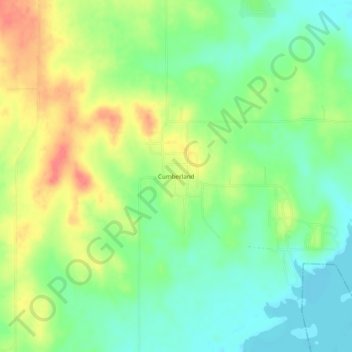
Name: Cumberland topographic map, elevation, terrain.
Location: Cumberland, Marshall County, Oklahoma, United States (34.04454 -96.61972 34.08454 -96.57972)
Average elevation: 212 m
Minimum elevation: 186 m
Maximum elevation: 249 m
Thank you for supporting this site ❤️
Make a donation
Make a donation