
Thank you for supporting this site ❤️
Make a donation
Make a donation
Panikhar topographic map
Click on the map to display elevation.
Thank you for supporting this site ❤️
Make a donation
Make a donation
About this map
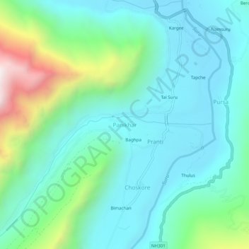
Name: Panikhar topographic map, elevation, terrain.
Location: Panikhar, Sankoo tehsil, India (34.09867 75.92676 34.13867 75.96676)
Average elevation: 3,465 m
Minimum elevation: 3,205 m
Maximum elevation: 4,373 m
Thank you for supporting this site ❤️
Make a donation
Make a donation