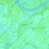
Click on the map to display elevation.
Name: Brietlingen topographic map, elevation, terrain.
Location: Brietlingen, Samtgemeinde Scharnebeck, Lüneburg, Lower Saxony, 21382, Germany (53.30844 10.39940 53.36400 10.50828)
Average elevation: 7 m
Minimum elevation: 1 m
Maximum elevation: 33 m
Click on a map to view its topography, its elevation and its terrain.
Germany > Lower Saxony > Lüneburg > Lüneburg > Lüneburg
Average elevation: 32 m
Germany > Lower Saxony > Lüneburg
Germany > Lower Saxony > Lüneburg > Bleckede
Average elevation: 24 m
Germany > Lower Saxony > Lüneburg > Amt Neuhaus
Average elevation: 13 m
Average elevation: 14 m