Geolocate

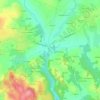
29390 topographic map

Click on the map to display elevation.

About this map

Name: 29390 topographic map, elevation, terrain.

Location: 29390, Scaër, Quimper, Finistère, Bretagne, France métropolitaine, France (47.95472 -3.83565 48.13018 -3.64012)

Average elevation: 159 m

Minimum elevation: 39 m

Maximum elevation: 264 m

Other topographic maps

Click on a map to view its topography, its elevation and its terrain.

Gerroué

France > Bretagne > Finistère > Scaër

Average elevation: 167 m

Pont Ledan

France > Bretagne > Finistère > Scaër

Average elevation: 169 m

Mine Groasne

France > Bretagne > Finistère > Scaër

Average elevation: 181 m

Kerliou

France > Bretagne > Finistère > Scaër

Average elevation: 178 m

Stang Dour

France > Bretagne > Finistère > Scaër

Average elevation: 170 m