
Shrewsbury topographic map
Interactive map
Click on the map to display elevation.
About this map
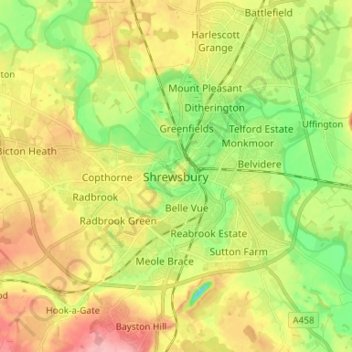
Name: Shrewsbury topographic map, elevation, terrain.
Location: Shrewsbury, Shropshire, West Midlands, Engeland, SY1 1SF, VK (52.66789 -2.79401 52.74789 -2.71401)
Average elevation: 71 m
Minimum elevation: 19 m
Maximum elevation: 131 m