
Thank you for supporting this site ❤️
Make a donation
Make a donation
Mamadapura topographic map
Click on the map to display elevation.
Thank you for supporting this site ❤️
Make a donation
Make a donation
About this map
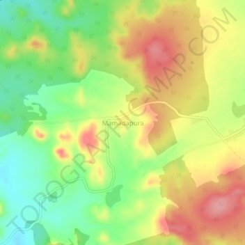
Name: Mamadapura topographic map, elevation, terrain.
Location: Mamadapura, Shiggaon taluk, Haveri, Karnataka, 581193, India (15.04059 75.09199 15.08059 75.13199)
Average elevation: 660 m
Minimum elevation: 603 m
Maximum elevation: 718 m
Thank you for supporting this site ❤️
Make a donation
Make a donation